Hi there! Welcome.
My name is Chinmay. I am a water resources scientist and a geospatial specialist with a passion for using technology and data-driven insights to solve multi-disciplinary, 21st-century challenges.
I lead the Water Security Thematic area at the SERVIR Science Coordination Office. SERVIR is a joint NASA and USAID partnership that harnesses the power of satellite data and science collaboration to support locally led efforts to strengthen climate resilience. Within the Water Security Thematic Area, we utilize Earth observation-driven services and capacity-building initiatives to help partners enhance sustainable access to freshwater and promote cooperation over shared water resources. I am particularly passionate about translating science into actionable insights to support environmental decision-making.
I hold a PhD in Water Resources Engineering from the University of Idaho. As a part of Dr. Erin Brooks' research group, my work focused on improving the understanding of the implications of various land management strategies on water quality. By employing advanced hydrology and water resources models, along with extensive geospatial datasets, I developed data-driven tools to inform stakeholders’ strategies in addressing climate risks and guiding environmental decision-making.
Previously, I had the privilege of being a Utrecht Excellence Scholar at Utrecht University in the Netherlands. During this time, I worked extensively with the PCR-GLOBWB model, a state-of-the-art global hydrology and water resources model. By integrating earth observation data and applying innovative approaches, my work focused on deriving critical water management insights in regions facing severe water scarcity.
Blog
Turning Data into Action: Three Ways SERVIR is Strengthening Water Security
Turning Data into Action Read more
Projects
The Deval in the Details Report
This is an automated data analytics tool designed to enhance the user experience for WEPPcloud users. It generates comprehensive run reports that include detailed and interactive graphical outputs and tabulated summaries of the WEPPcloud watershed run results. These reports can be easily downloaded and utilized for various purposes such as reports, presentations, or any other information needs. Read more
Publications
Persistence patterns in sub-field crop water use to guide variable rate management
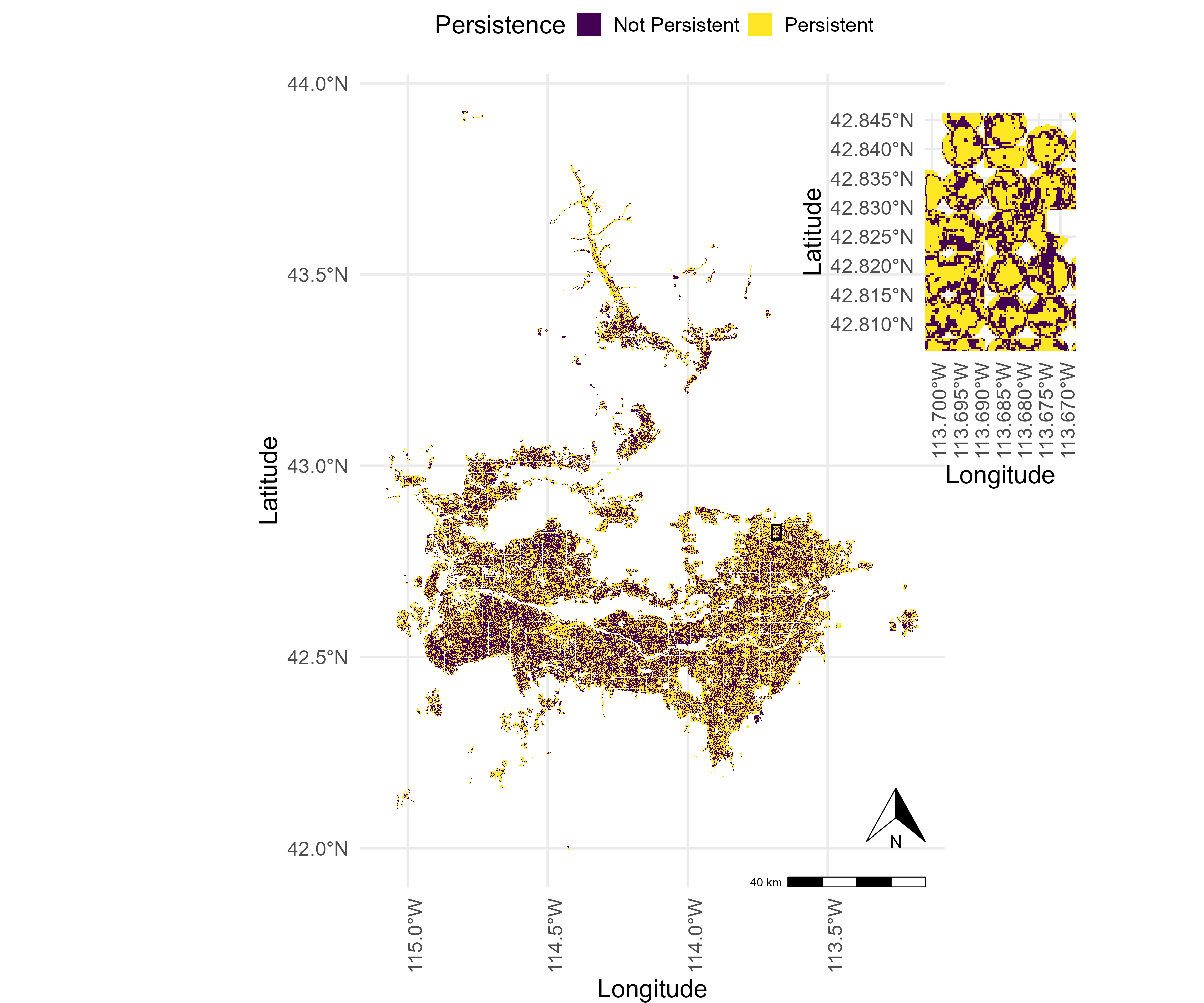
- Persistent patterns in crop water use exist within irrigated fields of Magic Valley.
- These persistent patterns are driven by dominant crop type, within-field topographic differences, and the soil’s physical properties.
- Persistence pattern maps can guide the targeted management of subfield field variability.
- Persistence pattern maps provide helpful information for farmers and agronomists to improve resource allocation and crop yields using variable rate management.
Authors: Chinmay Deval, Erin S. Brooks, Linda R. Schott, Jason Kelley, David L Bjorneberg
Journal:
DOI: 10.1088/3033-4942/addc8f
Talks
Intercomparing Surface Water Extent Mapping Products and Packages
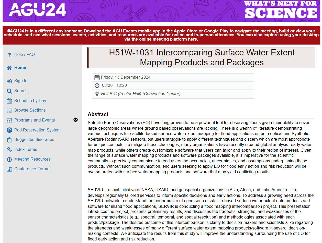
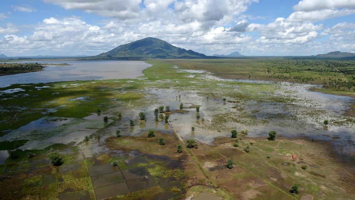
Satellite Earth Observations (EO) have long proven to be a powerful tool for observing floods given their ability to cover large geographic areas where ground-based observations are lacking. There is a wealth of literature demonstrating various techniques for satellite-based surface water extent mapping for flood applications on both optical and Synthetic Aperture Radar (SAR) sensors, but users struggle to apply different techniques and discern which are most appropriate for unique contexts. To mitigate these challenges, many organizations have recently created global analysis-ready water map products, while others create customizable software that users can tailor and apply to their region of interest. Given the range of surface water mapping products and software packages available, it is imperative for the scientific community to precisely communicate to end users the accuracies, uncertainties, and assumptions underpinning these products. Without such communication, end users seeking to apply EO for flood early action and risk reduction will be oversaturated with surface water mapping products and software that may yield conflicting results. SERVIR – a joint initiative of NASA, USAID, and geospatial organizations in Asia, Africa, and Latin America – co-develops regionally tailored services to inform specific decisions and early actions. To address a growing need across the SERVIR network to understand the performance of open-source satellite-based surface water extent data products and software for inland flood applications, SERVIR is conducting a flood mapping intercomparison project. This presentation introduces the project, presents preliminary results, and discusses the tradeoffs, strengths, and weaknesses of the sensor characteristics (e.g., spectral, temporal, and spatial resolution) and methodologies associated with each product/package. The desired outcome of this intercomparison is clarity to decision-makers and scientists alike regarding the strengths and weaknesses of many different surface water extent mapping products/software in several decision-making contexts. We anticipate the results from this study will improve the understanding surrounding the use of EO for flood early action and risk reduction. Read more
Featured categories
R (9) Shiny (6) package (3)Curious about all intersections of water, data and society.